production
/viewbook/list/all/?page=5059
/
/static/
None

Geography: Realms, Regions and Concepts
Authors:
H. J. de Blij
Publisher:
Wiley
Publication Date:
Not available
ISBN:
0470462426
The best-selling book in the World Regional Geography market, Regions provides general readers with up-to-date information on various topics around the... world. It delivers the authors' authoritative content, outstanding cartography, currency, and comprehensive coverage, in a technology-rich package. The 14th edition reflects major developments in the world as well as in the discipline. These range from the collapse of Russia's Post-Soviet transformation to the impact of globalization and from the rise of Asia's Pacific Rim to the war in Iraq. Readers will find accurate data and information in this streamlined resource.
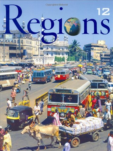
Geography: Realms, Regions, and Concepts
Authors:
H.J. de Blij
Publisher:
Wiley
Publication Date:
Not available
ISBN:
047171786X
Now substantially revised and updated, the Twelfth Edition of de Blij and Muller's Geography: Realms, Regions, and Concepts continues to deliver the... authors' authoritative content, outstanding cartography, currency, and comprehensive coverage, in a technology-rich package. The text reflects major developments in the world as well as in the discipline, ranging from the collapse of Russia's Post-Soviet transformation to the impact of globalization and from the rise of Asia's Pacific Rim to the war in Iraq.

Geography: Realms, Regions and Concepts, 11th edition
Authors:
H. J. de Blij
Publisher:
Wiley
Publication Date:
Not available
ISBN:
0471152242
Each chapter has been thoroughly revised to reflect the changing cultural, political, and physical landscape of our world.Increased coverage of... environmental change and the risks that the planet faces with 6.2 billion people.This new eleventh edition places more emphasis on critical thinking, human geography and environmental issues.

GEOGRAPHY SPARKCHART
Authors:
Not Available
Publisher:
Not available
Publication Date:
Not available
ISBN:
Not available
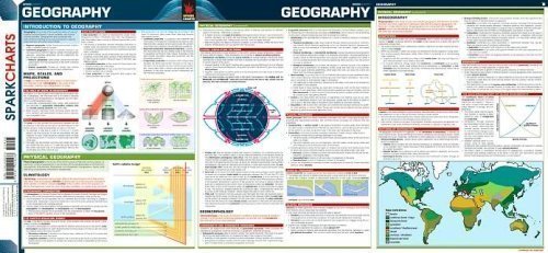
Geography SparkCharts
Authors:
SparkNotes Editors
Publisher:
Spark Publishing
Publication Date:
Not available
ISBN:
141140453X
Human Geography: Culture, Society and Space challenges students to think geographically across scale and across a wide range of geographical phenomena... and global issues. The authors engage the students throughout the text by posing geographical questions that encourage students to think critically about their own locality, region, nation, and world. In the Eighth Edition, the authors reformat the text to 14 chapters, provide a clear outline of key questions for each chapter, integrate their own field experiences, and rewrite the text to guide students through answers to geographic questions. The Eighth Edition includes three new chapters: "Identity: Race, Ethnicity and Gender," "Local Culture, Popular Culture, and Cultural Landscapes," and "Geographic Networks." The concepts of globalization, identity, development, sense of place, and construction of scale are infused throughout the text. The author team draws from studies in geography and across disciplines to bring a broad and up-to-date perspective on the kinds of research geographers have done and are currently doing on a wide range of human geography topics.In the Eighth Edition, de Blij and Murphy welcome new coauthor Erin Hogan Fouberg (South Dakota State University), who brings her expertise in geography education and political geography. The author team created a new pedagogy and writing style for the Eighth Edition that make the book more accessible to students and faculty.
Geoinformation: Remote Sensing, Photogrammetry and Geographic...
Authors:
Gottfried Konecny
Publisher:
CRC Press
Publication Date:
Not available
ISBN:
0415237955
Surveying and mapping has recently undergone a transition: from discipline-oriented technologies, such as geodesy, surveying, photogrammetry and... cartography, to the methodology-oriented integrated discipline of geoinformatics based on GPS positioning, remote sensing, digital photography and GIS for data manipulation and data output. This book presents the required basic background for remote sensing, digital photogrammetry and GIS in the new geoinformatics concept in which the different methodologies must be combined.For remote sensing, the basic fundamentals are the properties of electromagnetic radiation and their interaction with matter. This radiation is received by sensors and platforms in analogue or digital form, and is subject to image processing. In photogrammetry, the stereo-concept is used for the location of information in 3D. With the advent of high-resolution satellite systems in stereo, the theory of analytical photogrammetry restituting 2-D image information into 3D is of increasing importance, merging the remote sensing approach with that of photogrammetry. The result of the restitution is a direct input into geographical information systems in vector or in raster form. The fundamentals of these are described in detail, with an emphasis on global, regional and local applications. For data integration, a short introduction into the GPS Satellite positioning system is added. This textbook will appeal to a wide range of readers, from advanced undergraduates to all professionals in the growing field of geoinformation.
GEOL 1014 PHYSICAL GEOLOGY LABORATORY MANUAL
Authors:
Not Available
Publisher:
Not available
Publication Date:
Not available
ISBN:
Not available
GEOL 101 COURSEPACK ]CUSTOM[
Authors:
Not Available
Publisher:
Not available
Publication Date:
Not available
ISBN:
Not available
GEOL 105 CUSTOM LAB
Authors:
Not Available
Publisher:
Not available
Publication Date:
Not available
ISBN:
Not available
GEOL 105 LAB MANUAL ]CUSTOM[
Authors:
Not Available
Publisher:
Not available
Publication Date:
Not available
ISBN:
Not available
GEOL 107: EARTHQUAKES, VOLCANOES, AND CIV VERS 1
Authors:
Not Available
Publisher:
Not available
Publication Date:
Not available
ISBN:
Not available
Geol 110 Custom Lab Manual
Authors:
Not Available
Publisher:
Not available
Publication Date:
Not available
ISBN:
1256581275
GEOL113 ]CUSTOM[
Authors:
Not Available
Publisher:
Not available
Publication Date:
Not available
ISBN:
Not available
GEOL 125 COURSE READER
Authors:
Not Available
Publisher:
Not available
Publication Date:
Not available
ISBN:
Not available
GEOL 12 OCEANOGRAPHY WORKBOOK (REV. FALL 11)
Authors:
Not Available
Publisher:
Not available
Publication Date:
Not available
ISBN:
Not available
 '